Friday, July 09, 2010

Review of The Kids are All Right

Check out Lesbian Dad's lovely, insightful and encouraging review of this new film about a lesbian family.

Thursday, July 08, 2010

European Vacation Travelogue: Day 13, Connor's Pass and Inch Beach

So by now you must be wondering, when in the heck is their vacation going to end?

Yes, we were very very spoiled.

Even now, we still had a few days left. . . One that was unplanned and, at the time, unwelcome, but that is a story for a future day.

Today, the story is Inch Beach.

On day 13, BioMom and I enjoyed an hour or two on our own while the kids swam with other kids at the hotel. She had gone over Connor Pass at some point on another trip to Ireland and was nostalgic about it so, we took the opportunity to head up the pass again.

Let's just say that I need to take BioMom to Colorado. She was so impressed with this little "mountain" pass, I had (to be frank) expected more of it! That's not to say it wasn't beautiful, it was. To give you an impression what it is like, you can check out Connor Pass on Youtube and watch videos of people's entire descents on both a bike and in cars (although the car video is entertaining because you can see how narrow the roads are and you can hear a few "dear Gods!"). Here's another bike descent that lasts all of four minutes. Like I said, if BioMom was impressed with this, I'll hafta show her 14,000 foot mountains!

Here's how I would have loved the pass (in addition to heading up with BioMom of course).

Regardless, the views were beautiful and I took a little hike up to a higher point once our car reached the top. Check me out in the bottom picture.


The night before I had been reading the guidebooks and looking at the map when I noticed a little golden finger sticking out into the bay. On the map it was literally about an inch long. I looked closer and then referenced the guidebook and found out that it was called "Inch Beach."

We had to see what that was all about.

So again, we found ourselves grabbing lunch at a local grocery store (this type of dining saved us. Rather then a pub lunch for 30 Euros we spent half as much for food we enjoyed more! Oh, and the kids preferred it because I always picked up a couple of Kinder Surprises for them as well!).

As we approached the beach we knew we were in for something special:

Rows of cars were parked on the beach along with buses advertising surfing lessons. It was hot* and sunny and packed.

We headed down and started wading. Ten, unafraid of freezing temperatures of the North Atlantic, headed right in and at that moment, watching her, I realized that this was a moment of a lifetime and that I had to body surf with her in those amazing, if frigid, waves. And we did. For hours with little breaks in between. And then we talked BioMom into it.


By the end, we were so cold we could barely move our fingers, but it was worth it. Exhilarating and exciting and amazing, Inch beach may have been our highlight.


*Of course, being the beginning of June in Minneapolis when we left, I didn't know from hot. In retrospect, we found out that the temperature, by the end of the day was 23 degrees Celcius and the water, a bone-chilling 14. For a conversion, talk to Cousin who literally knew the formula (5/9 + 32) off the top of her head!

Wednesday, July 07, 2010

Day 12, Part II: The Dingle Peninsula


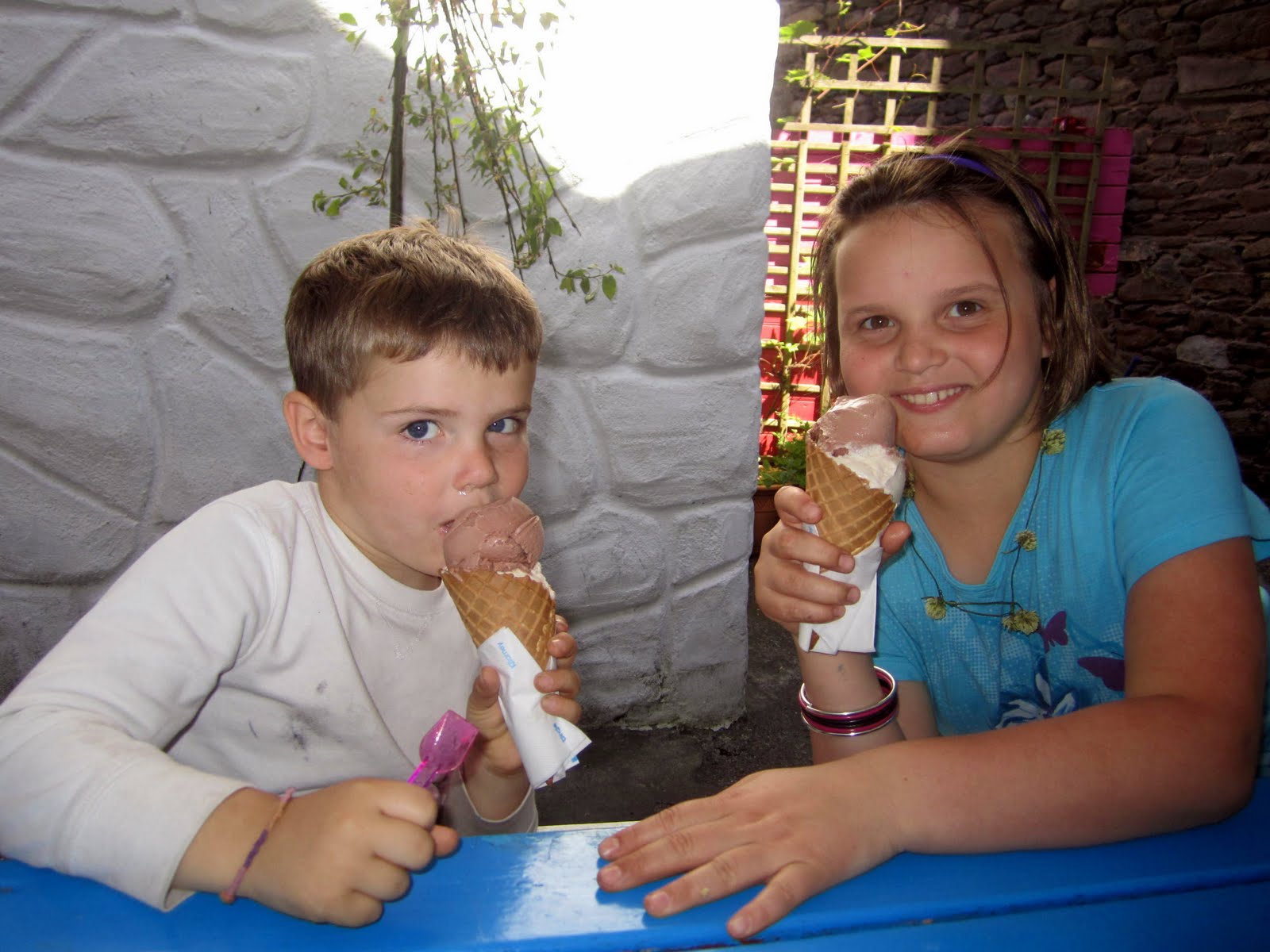
So after actually having seen Fungie, we headed back into Dingle Town for what was described as the best ice cream in Ireland: Murphy's.

I had Sea Salt and Kerry Cream. It was delicious.

Kids content, I talked everyone back into the car to take the Dingle Loop. I was interested not only in the views but of the over 2000 archeological sites that provide physical evidence from the Mesolithic Period, to the Stone age, the Bronze Age, the Iron Age, the early Christian Period, the Vikings and Medieval Period. Here's a great site that provides descriptions of some of these sites.

This can also be done by bike, and while it would be gorgeous and not too terribly long (for an adult), I cannot even imagine how stressed out one feels biking on these tight roads that cling to the cliffy coast. Whoa.

We headed west out of town to the Dun Beg Fort knowing that we had only a couple of stops in us as the kids couldn't wait to get back and swim in the pool a bit..

Dunbeg Fort, is a promontory fort on a sheer cliff that looks South onto Dingle Bay and is at the base of Mount Eagle. It was built in the Iron age and is a series of defensive ramparts and ditches around a central clochan.

The kids didn't get out of the car for this one as it cost a few Euros and I was the only one who seemed to be interested.


After indulging me, we headed on toward the Blasket Islands, skipping the beehive homes.

This was some of the most gorgeous scenery that I have ever seen in my life.

By now you'll have noticed Ten's signature trip pose. I love it, but can already see her 20 year old self cringe at picture after picture of the double-thumbs up. Or maybe she'll look back and giggle, remembering making fun of her middle-aged lesbian mom experiencing the entire Ireland trip through the camera's lens.

I had a signature pose at ten as well. It was something like an "a-okay" sign or and American Sign Language "f" with wink and perhaps even some sort of clicking sound accompanying the whole monstrosity. Ugh.


Heading around the tip of the peninsula we skipped a few more ancient archeological sites that we put on our "to do list" for next time, but stopped at the Kilmalkedar Church, a 12th century structure built by the Normans.

The ruined Romanesque church visible today dates to the first half of the 12th century, and certain features are similar to those found in Cormac's Chapel on the Rock of Cashel in County Tipperary. Also visible on the site are a sundial, large stone cross, and alphabet stone (inside the church near the chancel arch). Some fine stone carving can also be found inside the church.

The site is traditionally associated with St. Branden and there is a little path nearby called "Saint's Way" which leads to a hike up to Branden Peak (another on the "to do list").


We explored the area a bit. Big played hide and seek near this early Celtic Cross.


The Ogham stone with the inscription of "Anm Maile Inbir Maci Brocann" (which apparently is a name) is (at least according to the guidebooks) a place where locals come to "seal the deal". The upright stone is apparently a very famous, and excellent, representation of an Ogham stone from the 7th century.

We tried to "seal the deal", but apparently couples (or interested parties) need to use their thumbs. Maybe this could be viewed as a newer version for gay marriage.


And then we headed back to Dingle for a swim, a pint, and some more World Cup (as usual).

Tuesday, July 06, 2010

European Vacation Travelogue: Day 12 Part I, Fungie


So, Dingle Town and the Dingle Peninsula* are amazing and were certainly the highlight of our trip to Ireland. In a sentence, over the course of the few days we spent there, we saw a live dolphin, ancient forts and stone houses, we learned about the potato famine, BioMom and I "sealed the deal" at a 12th century church (and, as it turned out, using our fingers rather than our thumbs, we didn't do it correctly), and we body-surfed in 50 degree Atlantic waves on the largest beach I've ever seen.

On the first day we ventured out to Dingle Town to grab lunch in the harbor.

While BioMom and Ten foraged, Big and I walked to the end of the harbor to see what we could see.


I was very curious about a so-called Dolphin named Fungie that supposedly lived in Dingle and was in every piece of literature on the town that we had ever run across. Needless to say, I was extremely skeptical. There was also a big aquarium in the town and so I thought the whole thing was a tourist trap. So I thought, well, if we took our lunch out to the end of the harbor pier, maybe we'd get a glimpse of him (ha ha ha).

Big and I had one of those magical interactions with a local at the tip of the pier. I'm starting to think they were leprechauns or angels or something, giving us an extra hand just when we needed it.

So we're at the end of a long walk at the end of the pier, wondering if BioMom and Ten will meet us out here with sandwiches when out of nowhere a man stands up and strikes up a conversation with us. I guess he was fishing, but of all of the places in Dingle, he seriously chose one of the most tourist-laden points, not to mention the boats in and out. This is all to say that I have no idea why a local would choose such a spot to fish.

So I start asking questions like what the heck is that building across the harbor?

Oh that? He says. He goes on to tell me that it is a building that was essentially "make-work" during the famine. It lets sailors know where the beginning of the bay is.

I found a bit more about the Eask Tower online. It was built in 1847 and is built entirely of stone. It is crowned with the 19th century's mariners beacon and a World War II look-out post. This is because the mouth of Dingle Harbour is a "blind" mouth, and this beacon told sailors to let their sails down, enabling them to lose speed and to round the harbour mouth safely.

I then asked, tongue-in-cheek really, if we could get a look at this Dolphin.

I may have even exaggerated the word in my mouth a bit to him to be sure he knew that I knew that he knew that I knew that it wasn't real but that we were doing it for the kid wink wink.

In all seriousness, he pointed to this fort that we had noticed from the hotel


and said take a lunch over there to that fort. That's where he lives. You'll see him when a few boats start circling and revving their engines.

Seriously? I thought.

Yes. He read my mind. Apparently this dolphin, Fungie (pron: FOON-GEE) has lived in this entry of the Dingle Harbor for nearly 30 years now and, in contrast to what is known about dolphins living with other dolphins, he seems to prefer the company of humans. Visitors are virtually guaranteed to see him on a visit to Dingle!

So Big and I hurried back to the car and found BioMom and Ten and urged them to follow the suggestion of the man-of-the-sea we had just met.

Reluctantly, they got back into the car, lunch in hand, and we drove out a bit out of town to what barely constituted a road that lead to a not-very-clean beach, but a walking path to the fort. There we had our picnic and waited.


And waited and waited. And yes, that was the weather. In Ireland. Needless to say, waiting was NOT a problem.


And then, we saw him.


I'm going to sign off for now and report about the rest of Day 12 tomorrow.

*Rick Steves has a pretty great description of the area in a Smithsonian article that is available online. Check it out if you're interested.

Monday, July 05, 2010

European Vacation Travelogue: Day 11, Going to Dingle Via Doolin, Inisheer and the Cliffs of Moher


On the eleventh day we ventured away from Galway on what would end up being an epic journey to Dingle.

We were following (in reverse) the ghosts of my other brother who had also left the wedding to do a little southern travel, but who was leaving for the States a few days earlier than us. They highly recommended the Cliffs of Moher and in that travel-induced excitement that one gets ("we might never be here again!!") we subjected ourselves to a whirl-wind tour of part of Clare County's vivacious and breath-taking coast.

As we headed away from Galway and into the Burren, the dramatic cliffs on our right tumbled into Galway Bay. It was breathtaking and only a hint of what was to come in the days ahead.

I was a bit disturbed to see cars parked on the left hand side of the already not-very-wide road and wondered what people were doing. Here's a photo of the fishermen on the cliffs.


We didn't have time to stop and explore the Burren, to my great chagrin. Nor did I get any pictures for you, but please check out the link above. This part of the country is incredibly stark, and intimidating and even a bit ghostly. The guidebooks use words like "the moon" or "moonrocks" and that is also an apt way to describe these limestone hills that cover the region.

Throughout Ireland there are "ways" or long hikes through regions and the Burren was no different. There were maps for great walks through the Burren. The area is a "karst" landscape shaped by the dissolution of a layer or layers of soluble bedrock, usually carbonate rock such as limestone or dolomite. I put exploration of this area, with its ancient stone monuments and subterranean caves on my "to-do list" for the next time I am in Western Ireland.

We were heading toward a little town called Doolin which we heard was a great town to visit, have a pint at O'Connor's Pub, and get a boat tour of the Cliffs of Moher.

My brother and his wife had recommended the boat tour of the cliffs and we jumped on the idea. While in Galway, we explored the idea of taking a ship out to visit one of the Aran Islands, in particular Inishmore. We thought the kids would get a kick out of the boat ride and there is an incredible stone fort, Dun Aengus, at its western edge. The fort consists of three irregular semicircles, each a line of defense. Aside from the walls, one mode of defense is a band of stones set in the ground. Called a chevaux-de-frise, the stones are closely packed, set at an angle and intended to thwart an attack up the slope. And the view from the top of the parapet is supposedly stunning. "To the west is the expanse of the ocean to the horizon and 3000 miles beyond to North America. To the east is a moonscape, the rock strewn slope the walker must traverse and beyond, the openness of Inishmore and the stones of Aran everywhere."

But we were WAY to afraid to go. Check out Rick Steve's pictures of people hanging over the cliff to get a good look at the scenery.

With Big being, well, a spaz, and Ten being well, klutzy, and Ireland being, well, accident-prevention-challenged, we figured we couldn't afford to loose either of them.

All of this is to say that we had the same fears of the Cliffs of Moher (as Liz mentioned in her comment on an earlier post -- Hi Liz! Are you two coming out for the Minneapolis Marathon this fall?). My little guidebook had the following tidbit:
"From the car park and visitor center a stone walkway leads out to the cliffs, where you can continue on a short walk pretty darn near the edge, looking south to the cliffs themselves and out at the glittering sea. It's not wise to hop the railings, as tourists have been blown off the edge."

Yes. That read TOURISTS HAVE BEEN BLOWN OFF THE EDGE!!!

I did a quick Google search concerning this rather marginal comment over coffee with Cousin and found the following factoids:
1. The Cliffs of Moher are The Cliffs of Insanity from the movie The Princess Bride.
2. The same writer made the following comment: Nowadays you CAN reach the edge if you climb over some of the obstacles they have put up to stop you. You can also be blown off of them or have the ground crumble beneath your feet, plunging you a thousand feet to your death on the rocks below where other tourists will be able to take snapshots of your corpse for a few days.
3. I can't get a straight answer about how many people have actually been blown off. Apparently Ireland doesn't keep records of such tragedies.

Having said all of this, we head to the pier from Doolin to explore the possibility of seeing the cliffs from below.

A ship captain lets us know that despite the fact that we just missed one tour of the cliffs and would have to wait a couple of hours for the next one, he could get is on a boat "right away"!

This was the worst weather day we had had (and would ever have in Ireland), so we went back to grab our raincoats and water, and were told to meet at the boat.

It wasn't until it was departing that the captain told us that our tour of the cliffs would begin AFTER we had toured Inisheer Island and then boarded a different boat, Tranquility, from the island.


Normally we would have thought no big deal. But with Big, we knew we had limited time and energy on a cramped little boat looking at extraordinary scenery.* So we felt a bit bamboozled but tried to make up for it by enjoying a short hike around Inisheer and an ice cream.


After the island we headed toward the Cliffs of Moher.

They were extraordinary.

They rose out of the Atlantic and on this particular day had a halo of clouds covering their green tops. It was haunting.


But most haunting of all was one particular jagged protrusion that was home to thousands of birds. According to Wikipeda "there are many animals living on the cliffs. Most of these are birds, with an estimated 30,000 birds from 29 species. These include the noted Atlantic Puffins, which live in large colonies at isolated parts of the cliffs and on the small Goat Island. Also present are hawks, gulls, guillemots, shags, ravens and choughs."

Here are a few pictures. I tried to get some close-ups of the birds as well as a video to capture the sights and sounds, but the boat motor is basically all that you can hear.


Needless to say, the white strips on the outcropping are not a natural phenomenon.

We headed out after the trip to explore Doolin a bit
and then to skedaddle down to a coastal town near Kilrush where we thankfully caught a ferry and saved a few hours to get to our destiny: Dingle.


*At one point on the trip (we happened to be at the Westernmost part of Europe on the Dingle peninsula looking over the most extraordinary cliffs and beaches that you'll ever see), Ten breaks away from the Nintendo DS to tell us that she's "sick of hearing that she'll never see 'fill in the blank' again!"